Weslene Uy

Master of City Planning '22 at the University of Pennsylvania
Portfolio
Predicting Bike Share Trips
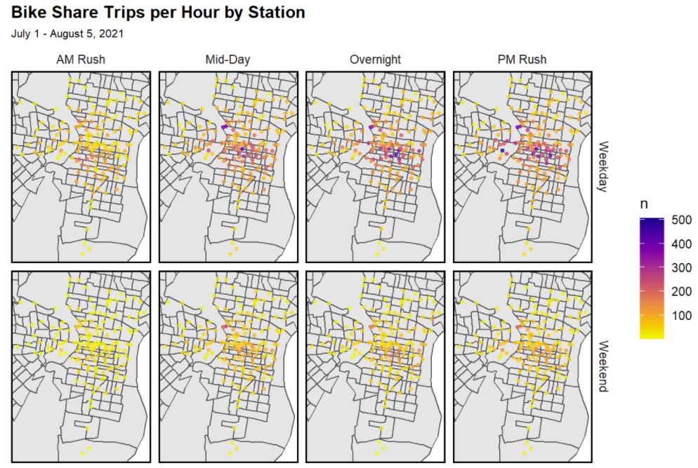
Using Indego’s trip data, I developed a spatio-temporal model to predict ridership demand. The model was trained on data from the first three weeks of July 2021 and tested on data from the last week of July and the first week of August 2021. View the project markdown here.
Traffic Crash Risk Modeling
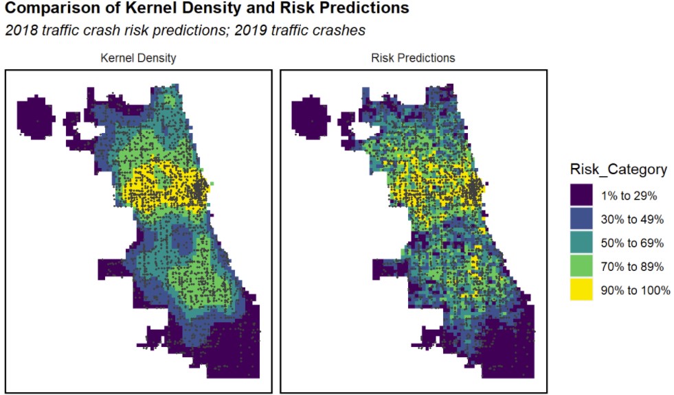
I built a geospatial risk model to predict traffic crashes in Chicago. This project also highlights the challenges around selection bias. View the project markdown here.
University City Worker Flows
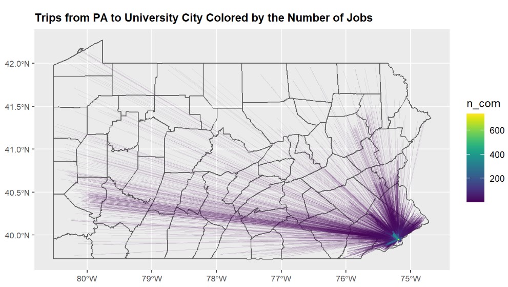
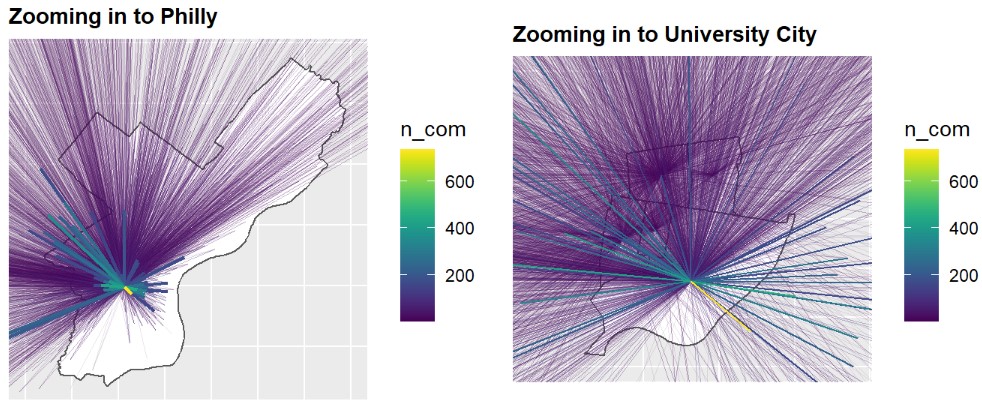
Using the stplanr package in R, our group visualized the Origin and Destination pairs of work trips from different counties in Pennsylvania into University City. View the project markdown here.
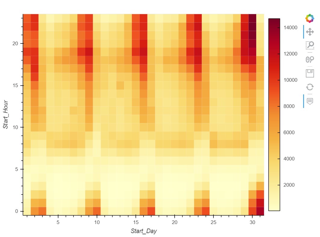
Ridesharing in Chicago
I prepared an exploratory and K-means cluser analysis of ridesharing in Chicago for the month of October (2021). View the project here.
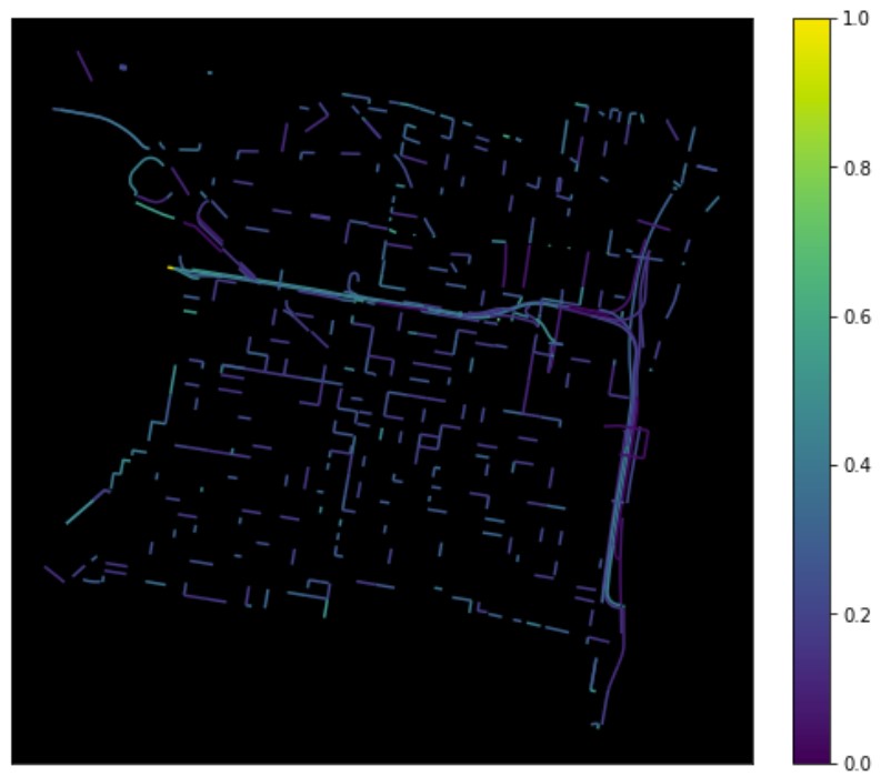
Crash Index
I used the OSMnx Python package to visualize the number of crashes per street in Philadelphia. I then calculated a crash index to normalize the measure of crash frequency per street. Index values range from 0 to 1.
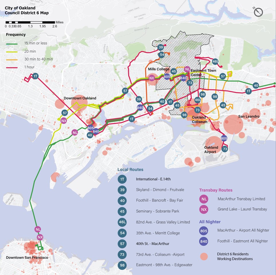
Equity Plan for Oakland’s District 6
For our planning workshop, our group proposed several strategies over a 20-year timeline for Oakland’s District 6. These strategies present a clear picture of what District 6 could be: a district which will continue to benefit from its strong tradition of advocacy, with diverse residents united around maintaining healthy, safe, and interconnected neighborhoods where they have opportunities to fulfill their potential. Notable contributions are excerpted from the report.
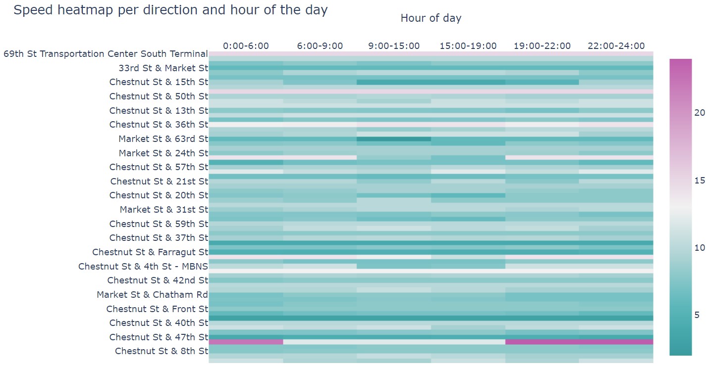
Speed Heatmap
I used the GTFS Functions package in Python to visualize the speed (in km per hour) heatmap of SEPTA’s Bus Route 21. View the interactive heatmap here.
Writing Samples
-
Drawing on my experience as a project officer at the Philippines’ Department of Transportation, I wrote a teaching case on the country’s flagship Public Utility Vehicle Modernization Program. View the case study here.
-
For my Multimodal Transportation class, I proposed strategies for managing parking in San Francisco. My recommendations are based on the teaching case published by HKS. View the memo here.
-
As a research associate at a think tank, I regularly contributed opinion articles to a leading business newspaper in the Philippines. My first op-ed Can We Spend, Spend, Spend? looks at the government’s plan to introduce new taxes to finance its ambitious infrastructure program. View my other articles here.